How we check a site
Example only. This shows our checks on a public appeal site, Land South of Banbury Road, Ettington (Stratford-on-Avon). It is not a site we are offering, and we have no involvement in it. Every point below comes from the appeal decision APP/J3720/W/25/3369800 or from a layer on our land map.
1. Find the title outline
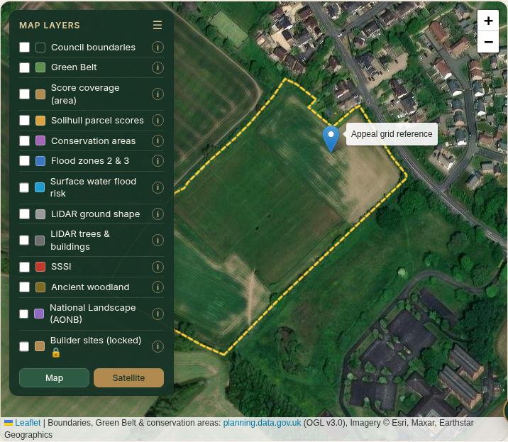
We start at the grid reference given in the appeal decision APP/J3720/W/25/3369800 (E427274 N248499) and find the registered title outline that covers it. The outline is a general boundary only and may not match the appeal red line. Ownership needs the title register, which we only check at the paid stage.
2. Green Belt and planning policy
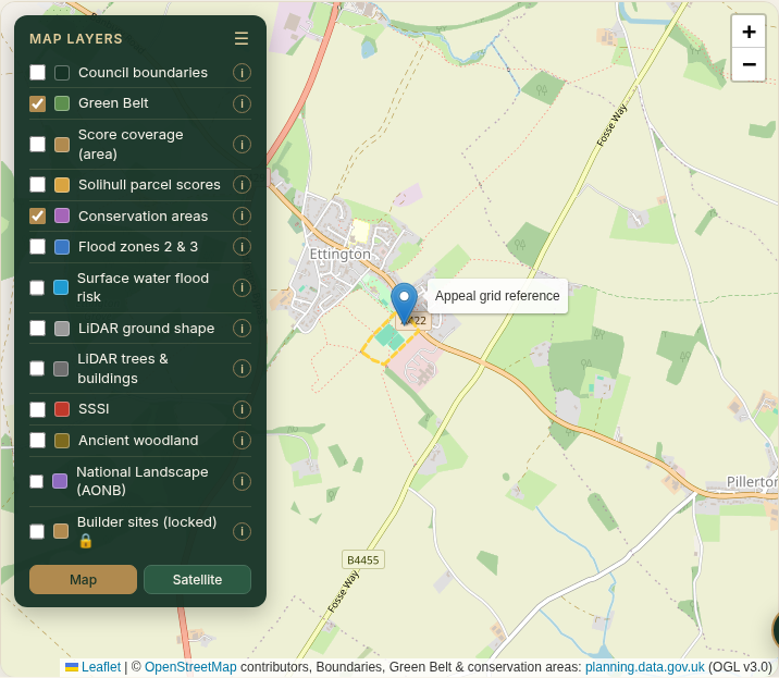
The outline is not in the Green Belt or a conservation area on planning.data.gov.uk. The appeal decision records that the land sits outside the village boundary, that part of it is a neighbourhood plan reserve site, and that it lies in the Feldon Parklands Special Landscape Area.
3. Flood and surface water
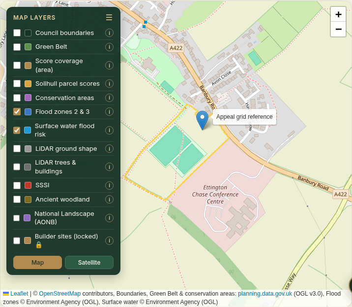
No flood zone 2 or 3, and no surface water flood risk, shows within the outline on the Environment Agency layers.
4. Ground shape (LiDAR)
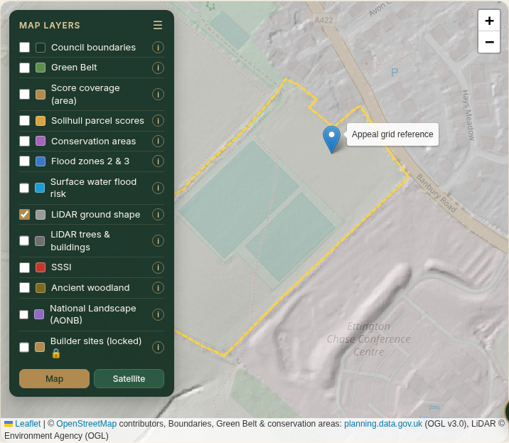
The LiDAR shows broadly even ground within the outline, with no obvious banks or ditches. The raised bank to the south-east lies outside it. LiDAR comes from surveys flown in different years, so we confirm on the ground.
5. Nature designations
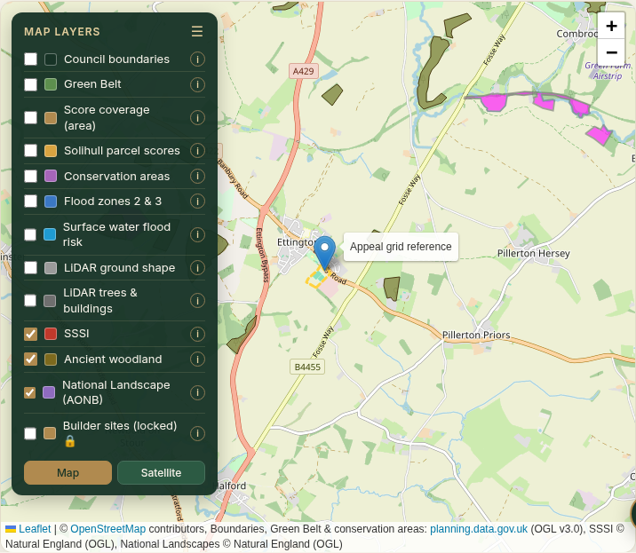
No SSSI, ancient woodland or National Landscape touches the outline. The nearest ancient woodland shown is outside the village.
6. Planning and appeal history
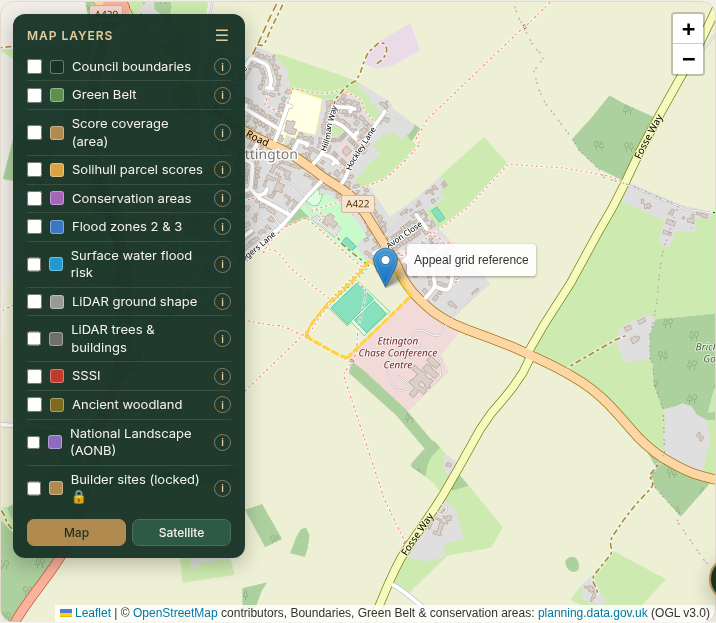
Application 24/00598/OUT was refused by Stratford-on-Avon District Council and allowed on appeal on 9 December 2025 (appeal decision APP/J3720/W/25/3369800). The inspector found the council could show a 2.74-year housing land supply, not the 5 years required, so the tilted balance in NPPF paragraph 11(d) applied. The decision also gave minor weight to the draft Site Allocations Plan and found the landscape effect contained.
7. Access
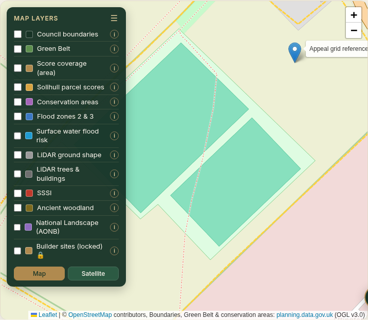
The outline has a frontage to Banbury Road (A422 on OpenStreetMap). The appeal decision records a new access from Banbury Road and that the highway authority did not object. We confirm widths and visibility with street-level imagery and a site visit.
We measure areas and overlay these layers in QGIS, the free professional mapping software.
What this shows
No single layer decides a site. Here, short housing supply, a neighbourhood plan reserve site and a contained landscape effect were weighed together by the inspector. We run the same checks on every site before we put it forward, then confirm against the title documents and on the ground.
Sources
- Planning Inspectorate, appeal decision APP/J3720/W/25/3369800, 9 December 2025
- Title outline: contains HM Land Registry data © Crown copyright and database right 2026, via planning.data.gov.uk (Open Government Licence)
- Green Belt and conservation areas: planning.data.gov.uk (Open Government Licence)
- Flood zones, surface water and LiDAR: © Environment Agency (Open Government Licence)
- SSSI, National Landscapes and ancient woodland: © Natural England (Open Government Licence)
- Base maps: © OpenStreetMap contributors; imagery © Esri, Maxar, Earthstar Geographics
A guide, not a survey or legal or planning advice. Layers viewed on 25 October 2026.